

Most everyone has heard of Google Maps, and many have used its "Street View" for navigation and directions, which allows the viewer to explore locations as if they were really there. But did you know that Google also offers "Street View Oceans" of underwater locations?
In an effort to document the Great Barrier Reef coral population off the coast of Australia, Google teamed up with the Catlin Seaview Survey to record underwater locations in 360-degree panoramic vision. The project's mission is to get a baseline record of the world's coral reefs in high-resolution imagery, while helping scientists monitor coral population changes over time. The end result is quite a success, with around 90 miles of reef surveyed and 150,000 GPS-located images available for marine scientists to study.
Due to the success of the initial survey of the Great Barrier Reef in 2012, the program is now global, branching out to various other locations around the world. The team's focus was on coral reefs in the Caribbean and Bermuda in 2013 and the South-East Asian waters in 2014. Notable locations around the world also include the Galapagos Islands, the Underwater Museum of Isla Mujeres, Florida Keys Coral Restoration and the Yongala Shipwreck World Heritage Marine Site.
For more information and to view the collection, visit Street View Oceans or watch the video below.
Video of Explore the ocean with Google Maps
Most everyone has heard of Google Maps, and many have used its "Street View" for navigation and directions, which allows the viewer to explore locations as if they were really there. But did you know that Google also offers "Street View Oceans" of underwater locations?
In an effort to document the Great Barrier Reef coral population off the coast of Australia, Google teamed up with the Catlin Seaview Survey to record underwater locations in 360-degree panoramic vision. The project's mission is to get a baseline record of the world's coral reefs in high-resolution imagery, while helping scientists monitor coral population changes over time. The end result is quite a success, with around 90 miles of reef surveyed and 150,000 GPS-located images available for marine scientists to study.
Related Reading: Virtual Dive with these Google Underwater Street View Locations
Due to the success of the initial survey of the Great Barrier Reef in 2012, the program is now global, branching out to various other locations around the world. The team's focus was on coral reefs in the Caribbean and Bermuda in 2013 and the South-East Asian waters in 2014. Notable locations around the world also include the Galapagos Islands, the Underwater Museum of Isla Mujeres, Florida Keys Coral Restoration and the Yongala Shipwreck World Heritage Marine Site.
For more information and to view the collection, visit Street View Oceans or watch the video below.
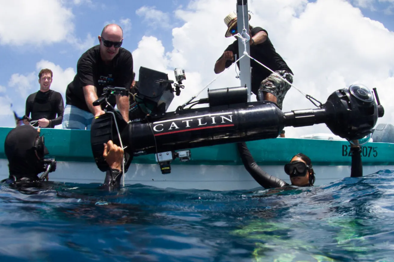
Underwater Earth - Lynton BurgerThe Catlin Seaview Support Team
The Catlin Seaview Support Team
The Catlin Seaview Support team helping move the SVII camera into the water. (Source)
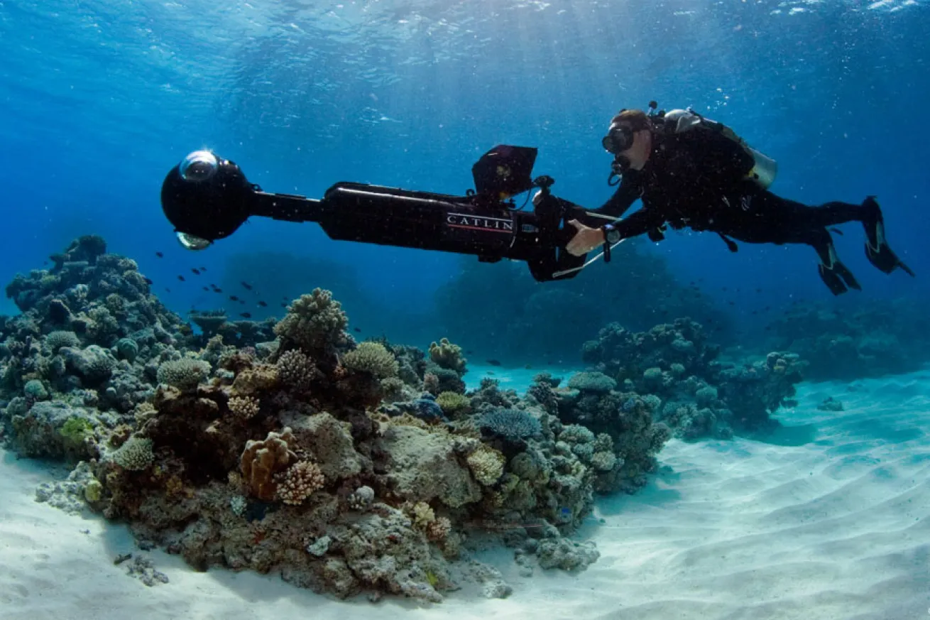
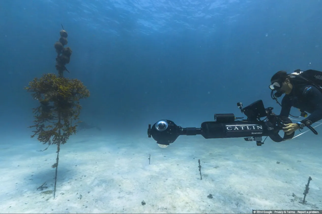
Underwater Earth - Jayne JenkinsA Catlin Seaview Diver Surveying Underwater
The Catlin Seaview SVII camera weighs 65 kg (143 lbs). Its takes three photos every three seconds, which are then stitched into panoramas. (Source)
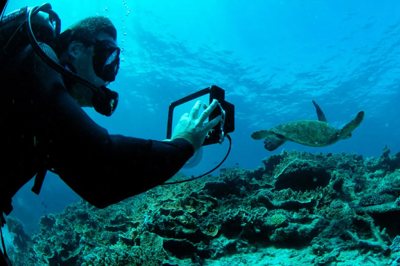
Underwater Earth - Richard VeversPosting Turtle Photos to Google+
Richard Vevers, project director of the Catlin Seaview Survey, is shown here taking a photo of a turtle using his tablet. According to Google, this image was the first underwater post to a Google+ page. (Source)
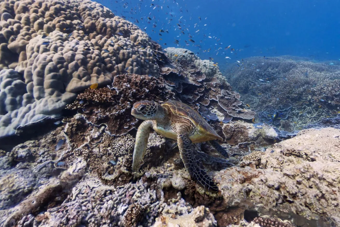
Google Maps Street View OceansTurtle on the Great Barrier Reef
Plenty of wildlife, including this turtle on the Great Barrier Reef, were "caught on camera" by the Catlin Seaview Survey team.
Google Maps Street View OceansTeam Divers Using Scooters
The Catlin Seaview team uses scooters to navigate over long stretches of distance, helping them conserve air and move more quickly over the reef. Using the scooter, divers can attain distances of over a mile in under an hour. (Source)
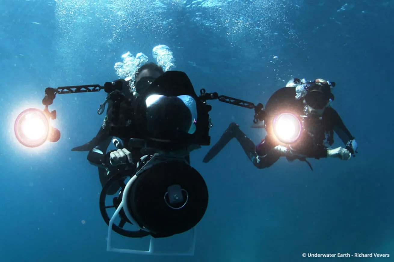
Underwater Earth - Richard VeversMembers of the Deep Reef Team
These divers are part of the Deep Reef Team, a group of divers who specialize in diving from 30 meters to 100 meters underwater — also known as the "mesophotic zone". (Source)
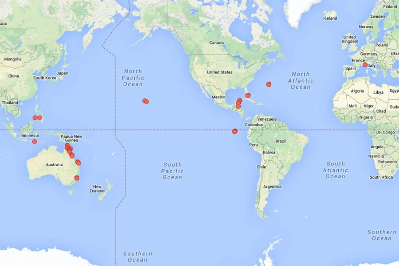
Google Maps Street View OceansGoogle Street View Oceans Locations
The locations of where the Catlin Seaview team has filmed.
Catlin Seaview Survey, NOAA/ONMS and the Florida Keys Natl. Marine SanctuaryCoral Restoration Nursery
The Coral Restoration Foundation grows endangered staghorn coral at the Snapper Ledge Coral Nursery located off Tavernier Key in Florida. Imagery captured by Catlin Seaview Survey, NOAA/ONMS and the Florida Keys National Marine Sanctuary. (Source)
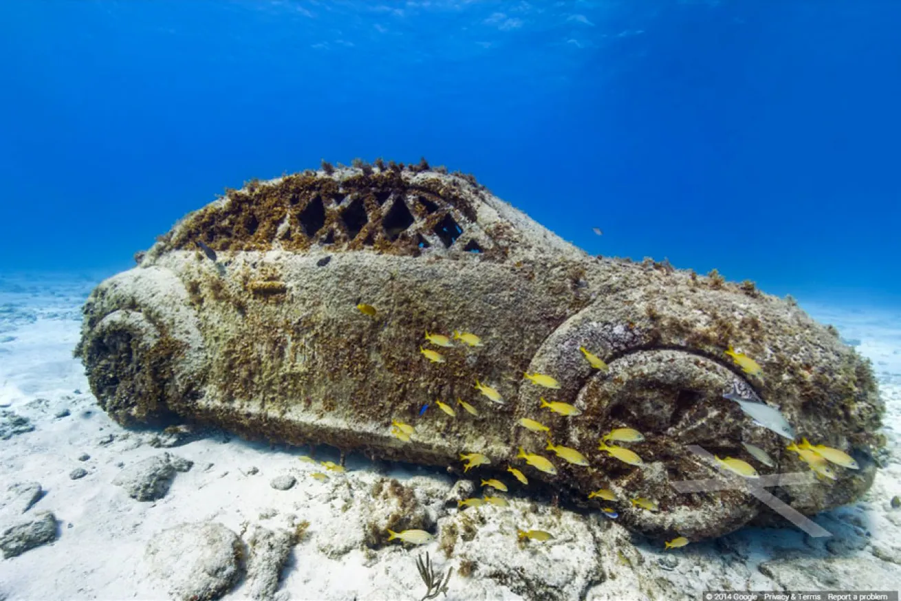
Catlin Seaview SurveyThe Underwater Museum of Isla Mujeres
In 2009, Jason deCaires Taylor began placing his pH neutral sculptures onto the seafloor of Isla Mujeres and Cancun, which is now known as the Cancun Underwater Museum. Image collect by Catlin Seaview Survey. (Source)
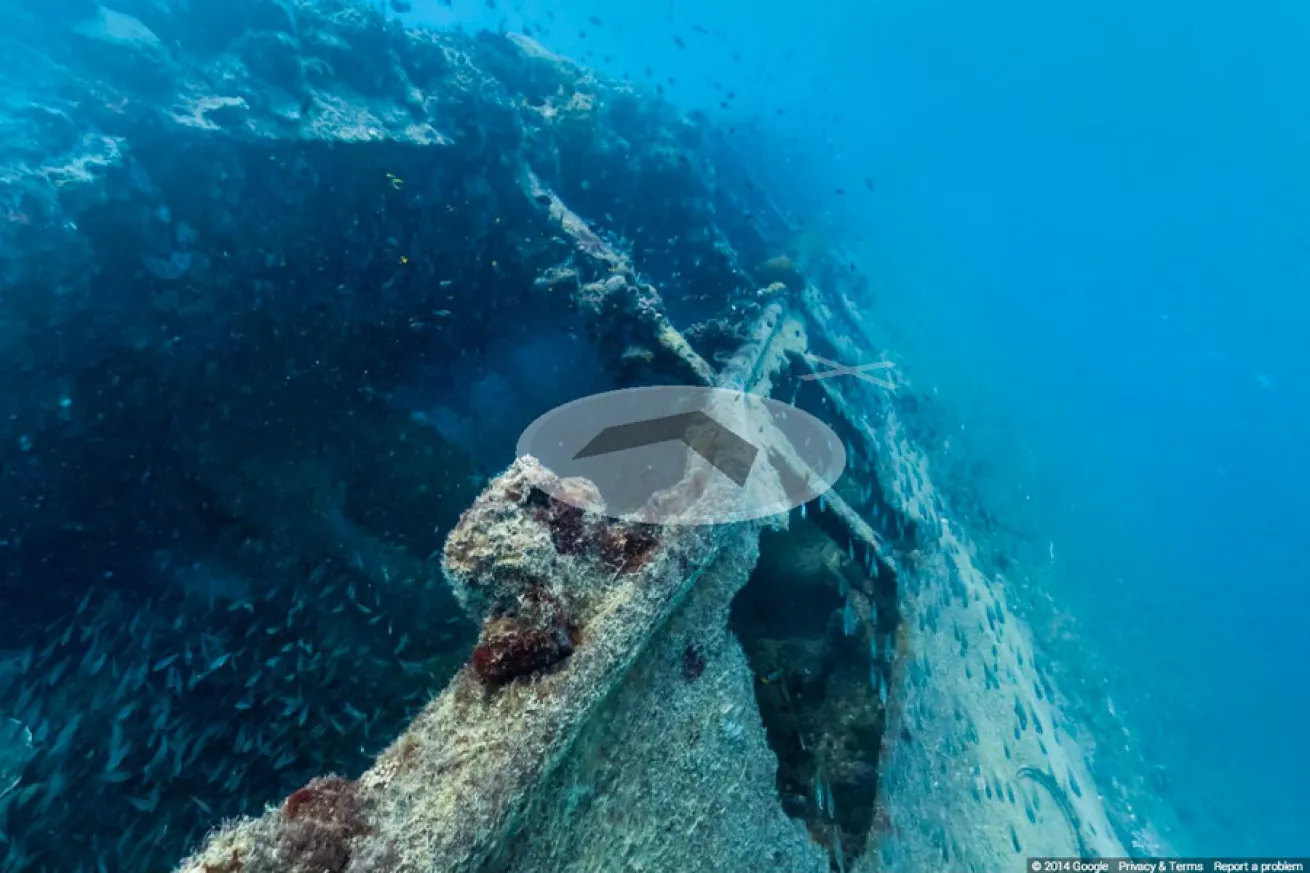
Catlin Seaview SurveyYongala Shipwreck
The Yongala Shipwreck is a 110-meter former steel passenger and freight steamer which sank in 1911 during a tropical cyclone with 124 passengers on board. The wreck lies at a depth of 33 meters and is consistently included on 'top 10 lists' for best dives in the world. The site has a strong current running over it which attracts a lot of marine life. Image collect Catlin Seaview Survey. (Source)
Catlin Seaview SurveyShelly Beach
Shelley Beach is a protected marine area (part of Cabbage Tree Bay) which was declared a "No Take" Aquatic Reserve in 2002. Since being listed as a protected area local scuba divers and snorkelers say they are seeing an increase in marine creatures here — a great observation. Image collect by Catlin Seaview Survey. (Source)
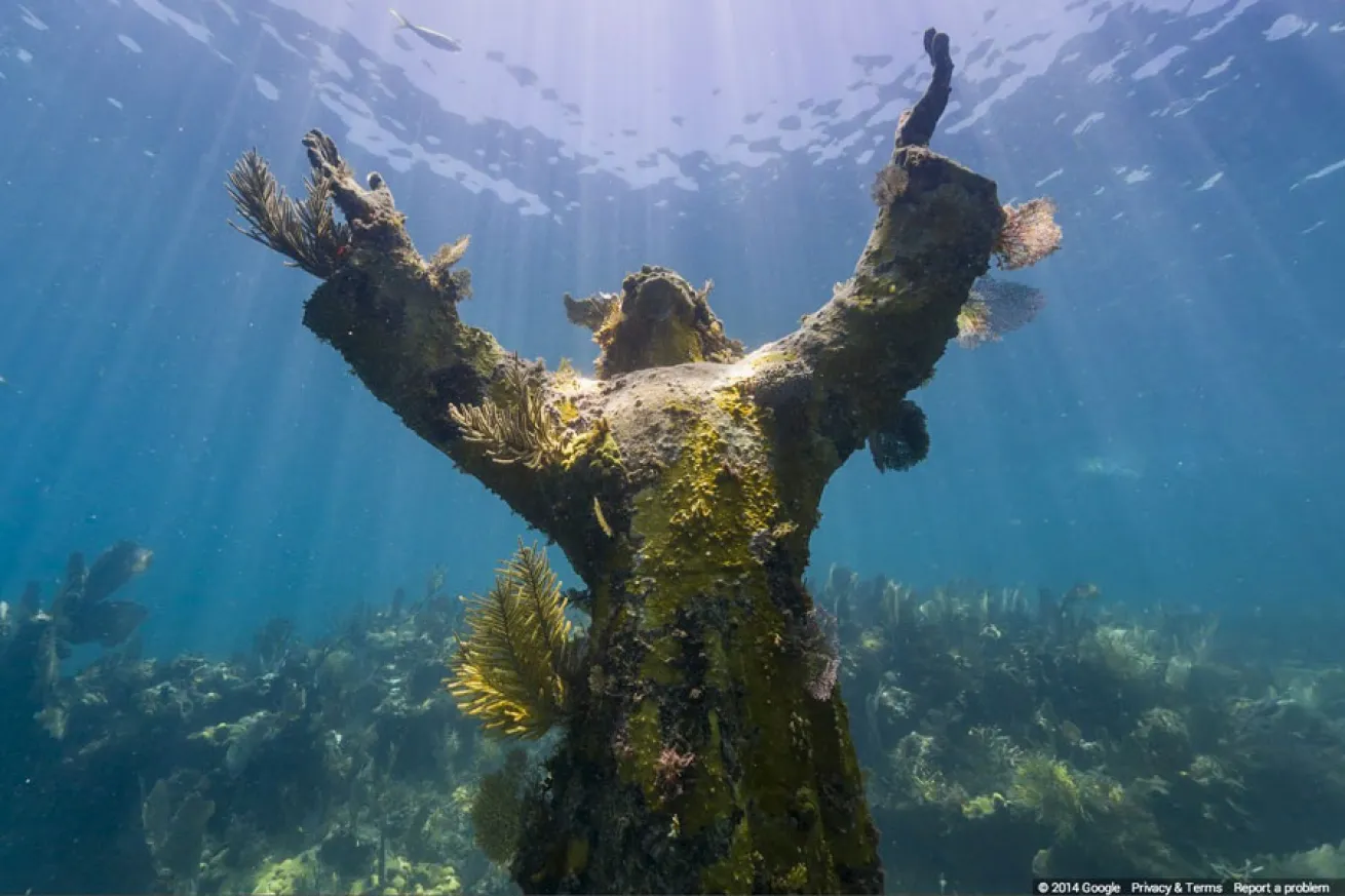
Catlin Seaview SurveyChrist of the Abyss
There are three "Christ of the Abyss" statues currently residing beneath the surface of the sea. This "American Christ" is the third and most recent in the set of bronze statues. It's located in the waters off Key Largo, Florida and was cast from the same mold as the original statue. Florida's "Christ of the Abyss" weighs 260kg but is secured to 9 tons of concrete — it's been here since 1965. Image collect by Catlin Seaview Survey. (Source)
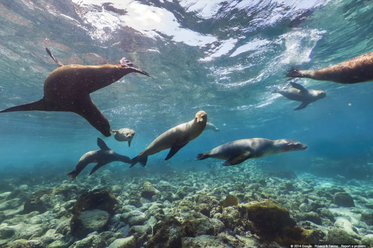
Catlin Seaview Survey in partnership with Charles Darwin Foundation and Galapagos National ParkPlayful Sea Lions
Inscribed on the UNESCO World Heritage list in 1978 and situated in the Pacific Ocean some 1,000 km from the South American continent, these 19 islands and the surrounding marine reserve are referred to as a unique ‘living museum and showcase of evolution’. Located at the confluence of three ocean currents, the Galápagos are a ‘melting pot’ of marine species; this dive features the playful Galapagos sea lions by Isla Campion (Champion Island). Image collect by Catlin Seaview Survey in partnership with Charles Darwin Foundation and Galapagos National Park. (Source)
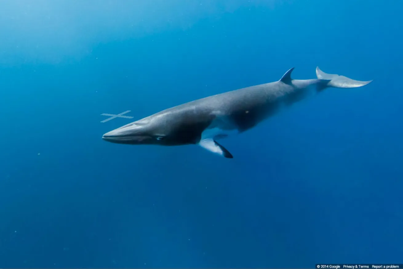
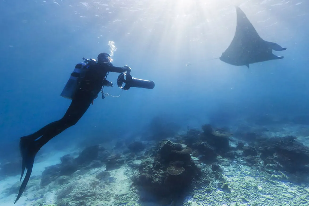
Google Maps Street View OceansMinke Whales on the Ribbon Reef
Dwarf minke whales travel through the Great Barrier Reef each winter where specialist dive operators and researchers wait to meet them. In 2014, the Catlin Seaview Survey team joined Mike Ball Expeditions to track the whales.
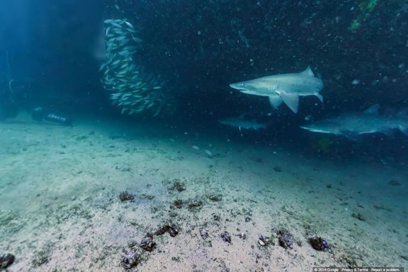
Catlin Seaview SurveyMagic Point at Maroubra, Sydney
The grey nurse shark is the world's most menacing yet harmless shark. Although they grow to be rather large and have rows and rows of razor-sharp teeth, they're not considered dangerous to humans — they're rather docile. They breed off the coast of Maroubra and provide a real thrill for scuba divers. Image collect by Catlin Seaview Survey. (Source)
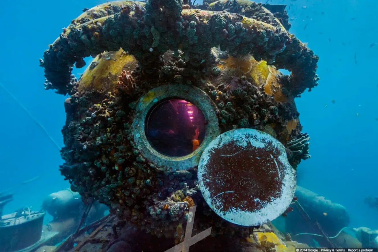
Catlin Seaview SurveyAquarius Reef Base, Florida Keys
The Florida International University manages the Aquarius Reef Base, which is a fantastic underwater habitat utilized by marine biologists and astronauts for research and training purposes. In August 2014, the Catlin Seaview Survey team visited Aquarius while surveying the reefs around the Florida Keys. Image collect by Catlin Seaview Survey. (Source)
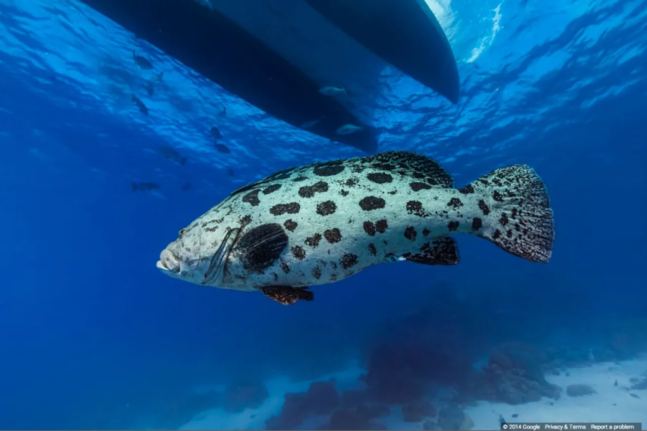
Catlin Seaview SurveyThe Cod Hole, Great Barrier Reef
Cod Hole was one of the first ever protected sites on the Great Barrier Reef, thanks largely to the efforts of Ron and Valerie Taylor, who in the early 1980s witnessed the huge cod population decimated by overfishing. This reef attracts a large variety of marine life aside from the resident potato cods, including big coral trout, all varieties of sharks, minke whales, dolphins and thousands of coral reef fish. See what else you can spot in this virtual dive on this truly world-class dive site. Image collect Catlin Seaview Survey. (Source)
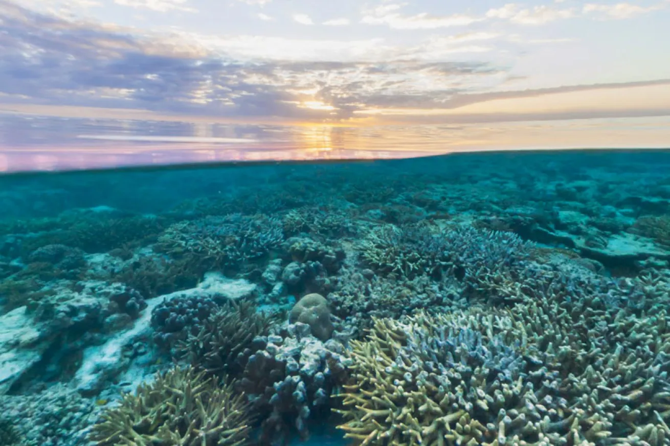
Google Maps Street View OceansThe Great Barrier Reef, Australia
The Catlin Seaview Survey Team captured stunning images from around the world, including this over-under shot from the Great Barrier Reef in Australia.
Google Maps Street View OceansGoogle Street View Oceans Locations
The various sites of Google Street View Oceans Locations.


