

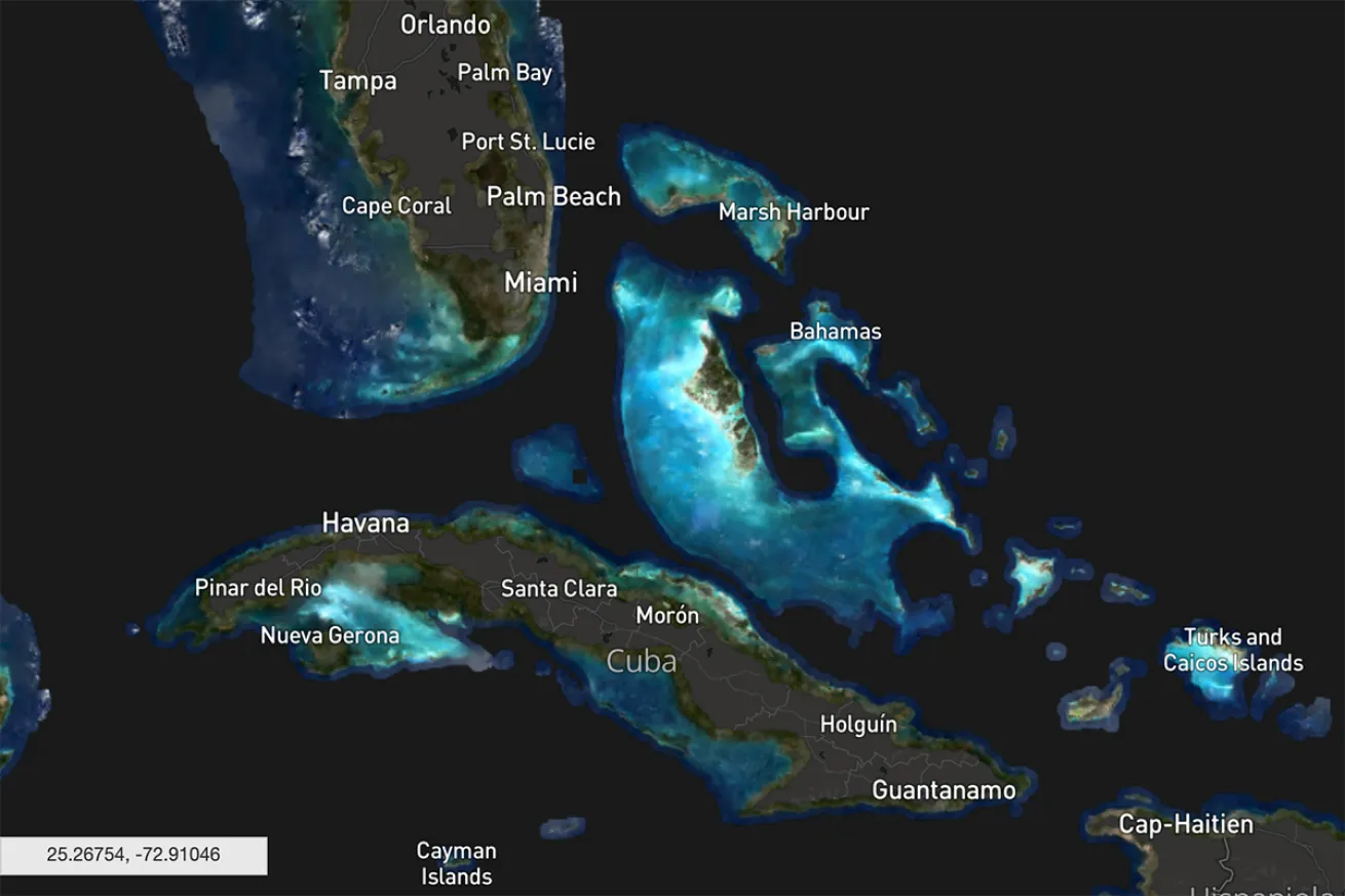
Allen Coral AtlasNearshore reefs are on display around Florida, Cuba and the Bahamas in the Allen Coral Atlas.
Researchers recently created first-ever complete map of the world’s shallow tropical coral reefs. Made from about 2 million satellite images, field data from over 450 research teams around the globe and novel mapping techniques, it took researchers at Arizona State University, the University of Queensland in Australia, National Geographic Society, Planet, and Vulcan three years to create. Part of global open-access coral monitoring and mapping program called the Allen Coral Atlas, it displays about 97,600 square miles of shallow-wear reef in high definition.
Users can toggle natural features, like satellite mapping of benthic components of the seafloor including sand, rock and seagrasses, or anthropogenic designations like the boundaries of marine protected areas.
The maps also have a tool to track near real-time data on global coral bleaching. When ocean heatwaves occur, corals can become overly stressed and die off. From 2009 to 2018, about 14 percent of corals died worldwide, many due to bleaching events. The hope, developers say, is that their work on the resource will translate into ocean action and better safeguarding of reefs against these types of threats.
“The true value of the work will come when coral conservationists are able to better protect coral reefs based on the high-resolution maps and monitoring system,” Greg Asner, managing director of the Allen Coral Atlas and director of ASU’s Center for Global Discovery and Conservation Science, says in a news release.
The atlas is already being used by governments in more than 30 countries, including Indonesia, Fiji, the Philippines, Kenya and Mozambique. Current applications including consulting the map to design future marine protected areas and other marine spatial plans.
“There are countries, organizations and government agencies in the world that don’t have a map of their reefs … so these maps will help people by basically giving a baseline to better assess where action is needed,” Chris Roelfsema, principal mapping investigator of the Allen Coral Atlas and a senior research fellow at the University of Queensland, tells Mongabay. “We can better make plans for marine protected areas, or we can extrapolate fish biomass or look at carbon stocks and all those kind of things that up until now were not possible.”
Developers say the finalization of the shallow-water coral maps makes the Allen Coral Atlas the most comprehensive, detailed and continually updated resource available.
In addition to consulting the maps for geographic planning, updates about threats such as coral bleaching can alert decision-makers in near real-time if they need to reduce other stressors in the area, such as tourism or commercial fishing. They can also identify any corals in their local waters that are more heat-resistant and that could help restore neighboring reefs.
“We must double down,” Asner says, “and use this tool as we work to save coral reefs from the impacts of our climate crisis and other threats.”


