

To divers who love wrecks, Otto Wagner and Raymond Poudrier are rock stars. They are the force behind ArtToMedia, which since 2006 has produced detailed card maps of wrecks and dive sites the world over, each with a distinctive look and thorough approach that immediately identifies it as an ArtToMedia creation. (Credit the look of the brand to Wagner, the art director.) Scuba Diving spoke to the pair about how it all began and what divers can expect next from the duo, based in Canada.
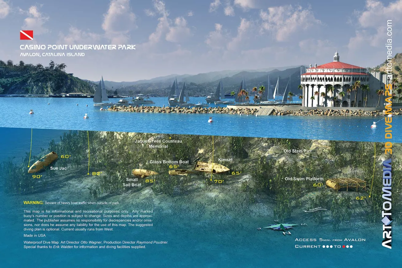
Courtesy ArtToMediaScuba Diving Map of Catalina, California
The team at ArtToMedia creates maps that look like a work of art to help divers explore shipwrecks more safely.
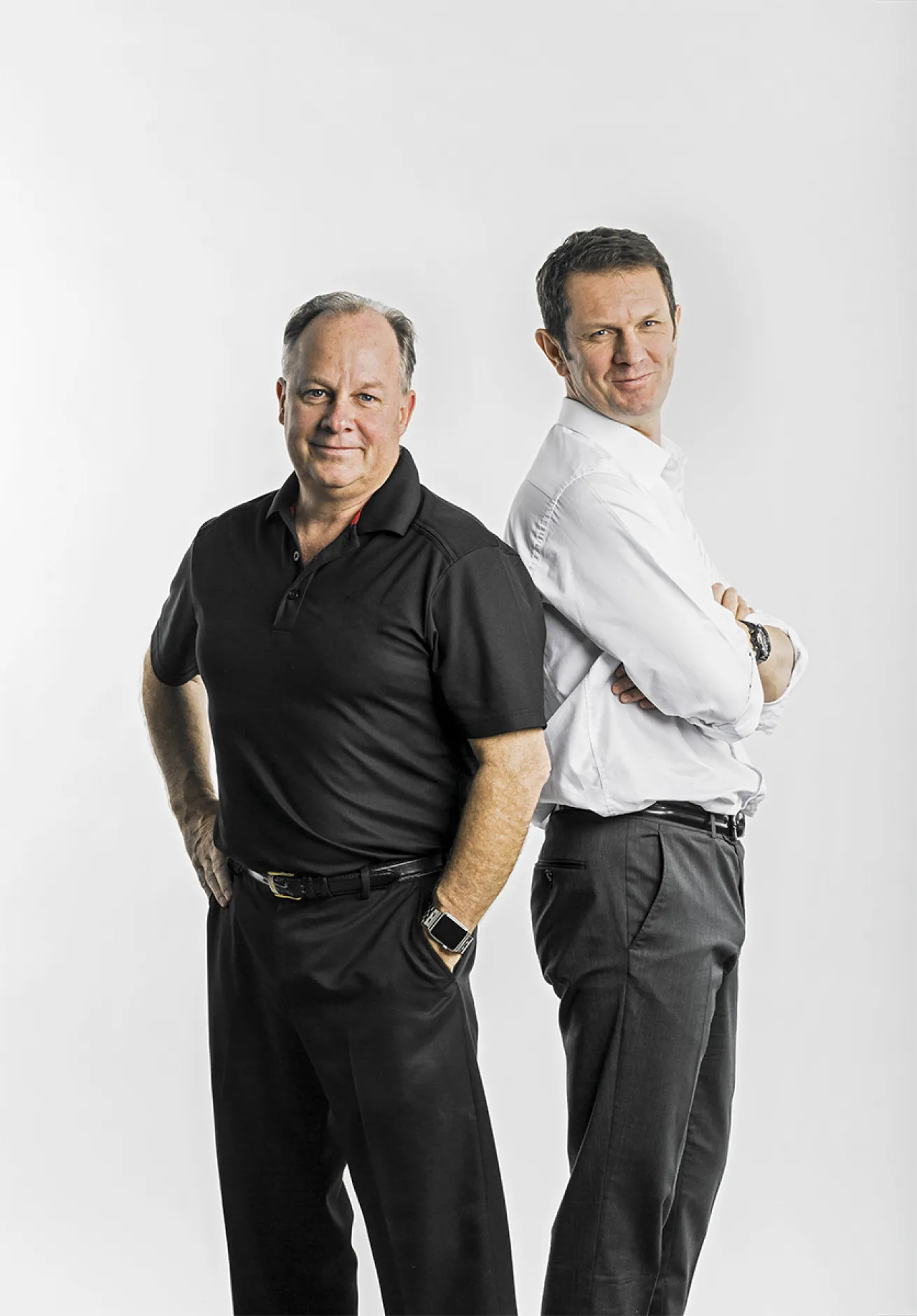
Riccardo CellereMeet the ArtToMedia Team
Otto Wagner (right) and Raymond Poudrier (left) are the driving forces behind ArtToMedia, which has produced detailed card maps of wrecks and dive sites the world over since 2006.
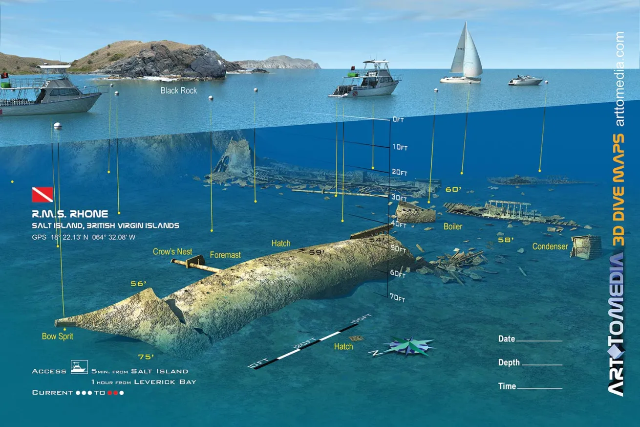
Courtesy ArtToMediaRMS RHONE, BRITISH VIRGIN ISLANDS
Create accurate and detailed maps of wrecks and dive sites like this one can take the ArtToMedia team months — and some have taken more than a year.
Q: WHAT'S THE PROCESS?
Raymond Poudrier: The first thing we do before we make a card is validate the value and the need for it. We do our research, then we involve local dive shops and dive communities.
Otto Wagner: It takes from one to six months — sometimes more — before a card goes to print, depending on the complexity of the site and the time it takes to gather all the right information.
Once we have decided on a new site, we do our preliminary research — Internet, dive shops, ministry of tourism, or any contact that can help us with information. Then we try to identify more sites in the same location.
We made a template with a detailed description of what we need to create a map, which is sent to those who collaborate with us. We have developed techniques to achieve the precision and accuracy we present in our dive maps. We need specific information, photos and/or videos, shore pictures, distance from the shore, etc. We sometimes have access through ship plans, and based on all of the information, we construct the ship in 3-D software that’s adapted to our specific needs so the measurements are accurate.
The dives are done mostly to see how preparation for sinking of the vessel, time and hurricanes have affected the wreck. For Grand Cayman’s Kittiwake we took notes, pictures and HD video for measurements while the vessel was prepared for sinking in Norfolk, Virginia. Based on that new information, we built the 3-D model to match.
In situations where models or measurements of the ship are unavailable, we will send the model to dive shops for corrections before applying texture and rendering the image.
Then the 3-D model is prepared for its final rendering. (If the information is available — via a government agency or an artificial reef organization — we don’t need to send the models for correction.)
Over time we have developed our own textures to reproduce as much as we can the feeling of an underwater scene. We use editing software to insert logos and text, and the next step is print.
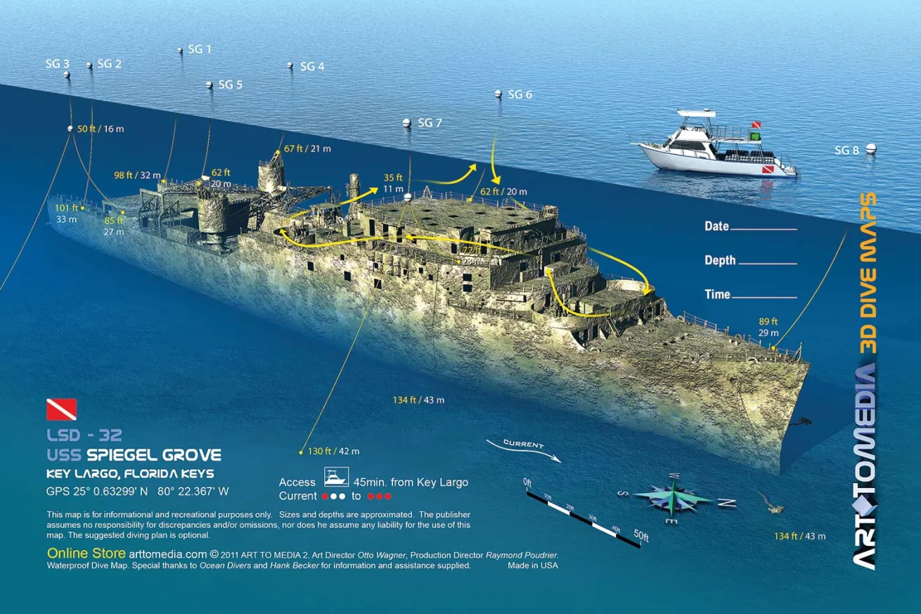
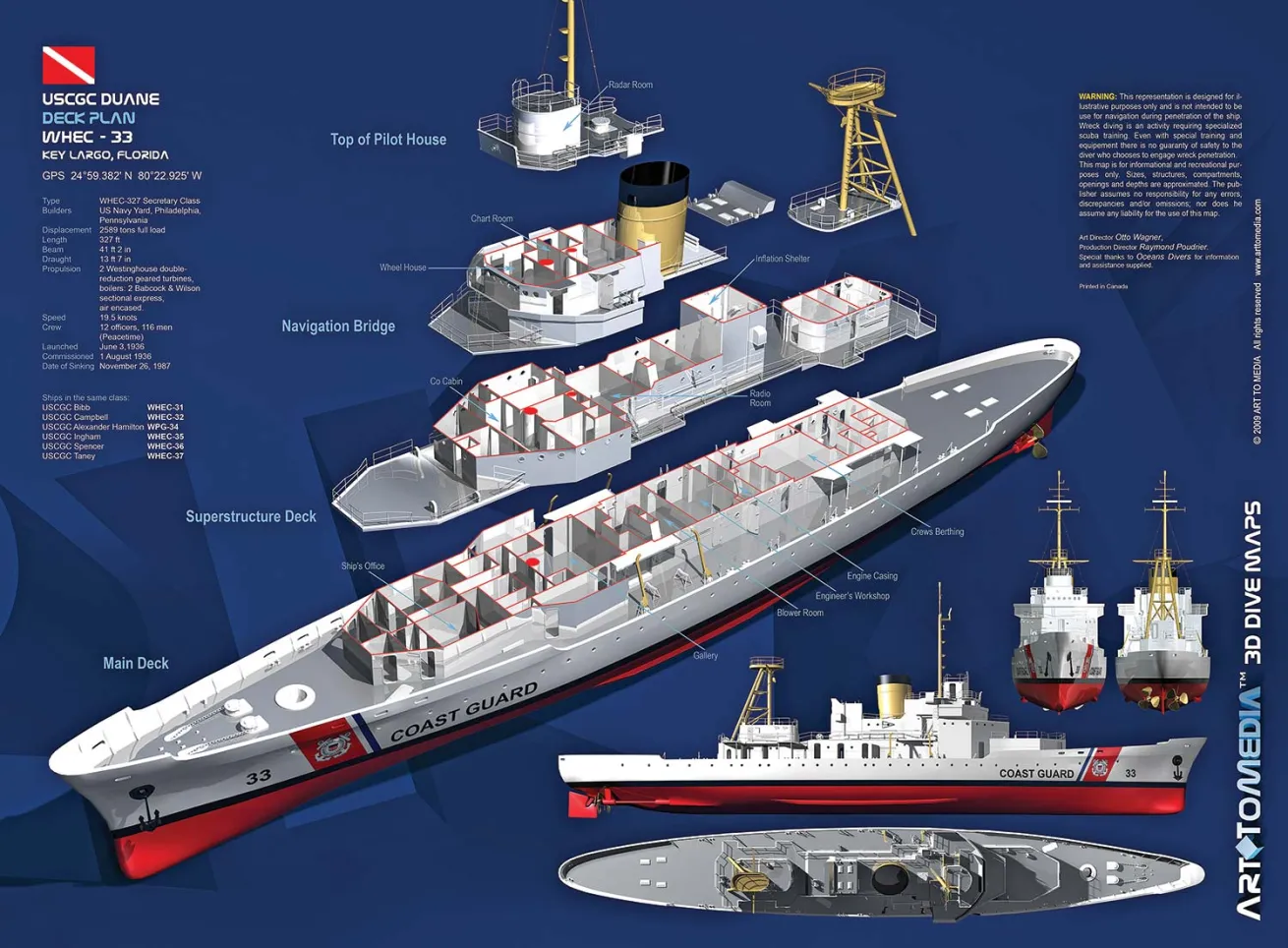
Courtesy ArtToMediaUSS SPIEGEL GROVE, KEY LARGO, FLORIDA
In 2006, the team at ArtToMedia created their first unique maps of the Spiegel Grove (pictured) and the Duane (both Key Largo, Florida).
Q: HOW DID ARTTOMEDIA GET STARTED?
OW: In 2005, I was vacationing in the Keys and at the dive shop they told me about a wreck called Spiegel Grove. When we arrived at the site, I saw just the blue sea and a few buoys — I had no idea where I was going and what I should look for. After the dive, I said to myself that divers are missing pertinent information about the site. (The captain told me divers often take the wrong ascending line and come out at another boat.) The same year, in Egypt, I had a similar situation — maps with archaic illustrations of the sites we had just dived. That was it.
RP: When Otto moved to Canada, he worked for me at my automotive company and taught me everything I know about Photoshop and 3-D imaging. The company suffered after 9/11 because of the restrictions on importing products, so during that time we went our separate ways. But after Otto came back from diving, he reached out to me and said: “The way these shipwrecks are mapped is archaic — the people at the dive shops are great instructors but poor artists. We’ve got to do something!” He told me his idea, and after some brainstorming, we decided to become partners.
HOW DO YOU CHOOSE THE WRECKS OR DIVE SITES?
OW: At the beginning, it was a marketing decision — the places with the most dives a year. Once we started to become known, dive shops, shipwreck associations, government agencies like NOAA, and tourism agencies were asking for specific sites. For our first DEMA show we had both wrecks and coral reef sites, but we realized people wanted more wrecks.
Courtesy ArtToMediaSS YUKON, SAN DIEGO
In 2008, ArtToMedia created their first large-scale paper maps of the Duane and Yukon (pictured). That same year, they began waterproofing all of their maps.
WHICH OF YOUR MAPS WAS THE HARDEST TO EXECUTE?
OW: Probably the set of Pupukea Marine Life Conservation District maps for Oahu, Hawaii, due to the complexity of the terrain: volcanic rocks, tubes and caves.
RP: There are two wrecks that come to mind: The first was Bentwood — that took us three years because we needed to get the facts right. So we had use underwater video cameras and go through the wreck from top to bottom. The second was the Empress of Ireland, which took more than a year and required a team of seven archeologists and a group of divers.
WHAT WOULD YOU MOST LIKE TO COVER IN THE FUTURE?
OW: As a personal challenge, we are hoping to do the famous cenotes like the ones in Playa del Carmen, Mexico.
WHAT'S YOUR FAVORITE PART OF YOUR WORK?
RP: The human interaction is the best part. Getting to work with passionate people who see the need and directly benefit from this kind of resource and want to participate. We realized that even if we dove every single wreck ourselves, it would be too costly and too time-consuming — working with local pros was the best solution. A lot of people photograph their dives, but you can’t get the overall scale of the wreck that way. This is a souvenir of your whole dive: You can say, “I was right there.” I love it at DEMA when divers and instructors tell us how valuable the maps have been for their dive planning and briefings. The maps reduce anxiety for divers; with a map, they concentrate differently on the briefing. Instead of trying to remember just a sketch, they have a better idea what they’re going to do. It’s like going to a new city — if you have a map, it makes you more secure.
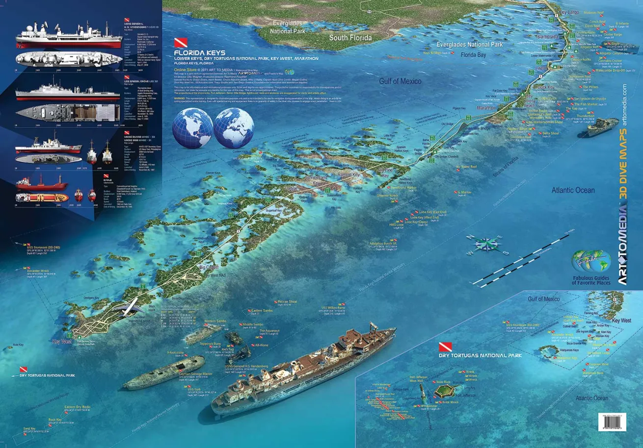
Courtesy ArtToMediaFLORIDA KEYS MAP
In 2011, they created their first map on synthetic paper, of the Florida Keys.

Courtesy ArtToMediaVIRTUAL MAPS FOR DIVE COMPUTERS
In 2013, the team created virtual maps created for the Mares Icon dive computer.
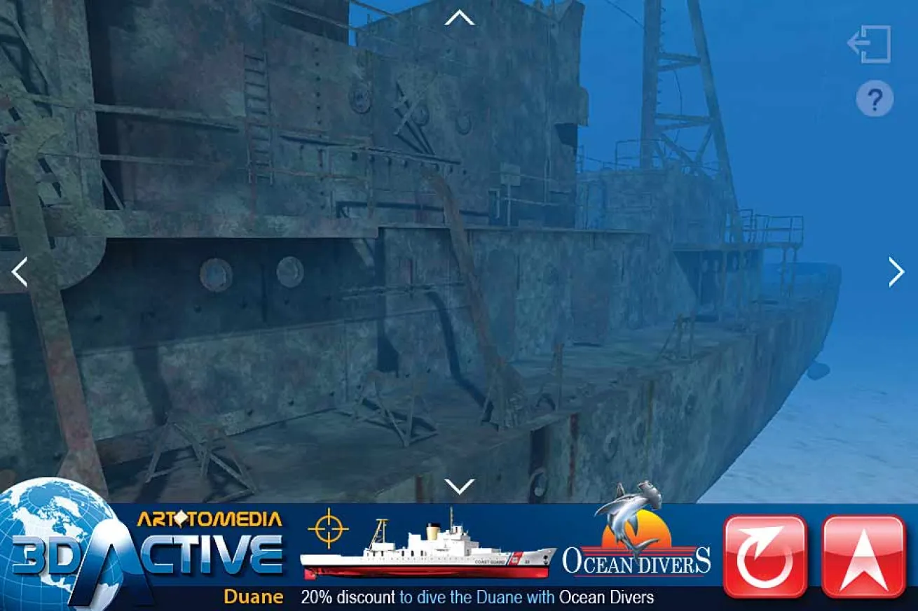
Courtesy ArtToMediaVIRTUAL TOURS
Now, the ArtToMedia team is working on creating virtual tours of shipwrecks including the Spiegel Grove for iPhone and iPad users.


