

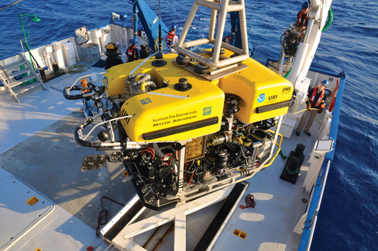
Hercules and Argus
The remotely-operated vehicles Hercules and Argus are used to view the seafloor through high-definition video cameras and to collect various specimens.
Courtesy Ocean Exploration Trust
The man who discovered the Titanic and transformed his fame and fortune into the Center for Ocean Exploration and Archeological Oceanography in Rhode Island has taken his show on the road this year, and fans can watch the daily action via a live streaming-video feed. In June, Ballard’s Nautilus exploration vessel embarked on a six-month research voyage from the Gulf of Mexico through the Caribbean Sea to map the geological, biological, archeological and chemical aspects of the region.
Using remote-operated vehicles, extensive sonar equipment and other advanced technology, a rotating team of experts aboard Nautilus is probing the ocean to depths of 6,000 feet. The first mission examined the reaction of the Gulf of Mexico’s ecosystem to the Deepwater Horizon disaster of 2010. Scientists from a variety of disciplines studied microbial activity, deep coral communities, water chemistry, and other aspects to see how the oil and gas seepage has affected the environment.
Through November 2013, the Nautilus will explore into the Caribbean, including Cayman Islands, Puerto Rico, Montserrat, Grenada, and Trinidad and Tobago.
To follow the Nautilus mission and to view the live, narrated video stream, visit nautiluslive.org.
THE BALLARD TEAM TOOL BOX
E/V Nautilus The 211-foot research vessel is equipped with state-of-the-art exploration and telepresence technology.
ROVs Rated to 4,000 and 6,000 feet respectively, remotely operated vehicles Hercules and Argus are used to view the seafloor through high definition video cameras and to collect geological and biological specimens.
Towfish Side-scan sonar systems, nicknamed Diana and Echo, are towed behind the ship to depths between 1,200 and 12,000 feet.
Multibeam Sonar The hull-mounted multibeam system uses side-scan and subbottom sonar to map the seafloor and identify targets for closer investigation and study.
Subbottom Profiler This echosounder penetrates layers of sediment to create a cross section of the seafloor.
Courtesy Ocean Exploration TrustThe remotely-operated vehicles Hercules and Argus are used to view the seafloor through high-definition video cameras and to collect various specimens.
The man who discovered the Titanic and transformed his fame and fortune into the Center for Ocean Exploration and Archeological Oceanography in Rhode Island has taken his show on the road this year, and fans can watch the daily action via a live streaming-video feed. In June, Ballard’s Nautilus exploration vessel embarked on a six-month research voyage from the Gulf of Mexico through the Caribbean Sea to map the geological, biological, archeological and chemical aspects of the region.
Using remote-operated vehicles, extensive sonar equipment and other advanced technology, a rotating team of experts aboard Nautilus is probing the ocean to depths of 6,000 feet. The first mission examined the reaction of the Gulf of Mexico’s ecosystem to the Deepwater Horizon disaster of 2010. Scientists from a variety of disciplines studied microbial activity, deep coral communities, water chemistry, and other aspects to see how the oil and gas seepage has affected the environment.
Through November 2013, the Nautilus will explore into the Caribbean, including Cayman Islands, Puerto Rico, Montserrat, Grenada, and Trinidad and Tobago.
To follow the Nautilus mission and to view the live, narrated video stream, visit nautiluslive.org.
THE BALLARD TEAM TOOL BOX
E/V Nautilus The 211-foot research vessel is equipped with state-of-the-art exploration and telepresence technology.
ROVs Rated to 4,000 and 6,000 feet respectively, remotely operated vehicles Hercules and Argus are used to view the seafloor through high definition video cameras and to collect geological and biological specimens.
Towfish Side-scan sonar systems, nicknamed Diana and Echo, are towed behind the ship to depths between 1,200 and 12,000 feet.
Multibeam Sonar The hull-mounted multibeam system uses side-scan and subbottom sonar to map the seafloor and identify targets for closer investigation and study.
Subbottom Profiler This echosounder penetrates layers of sediment to create a cross section of the seafloor.


