

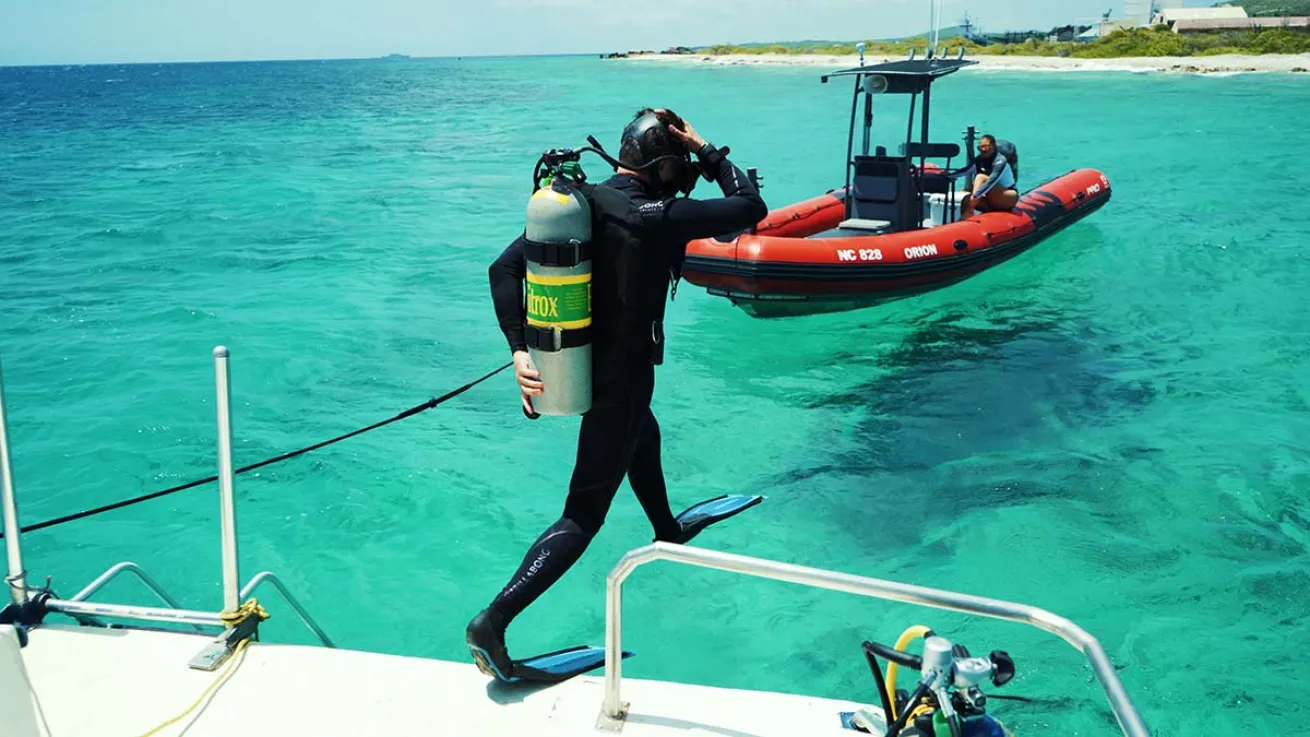
Proteus Ocean GroupFabien Cousteau dives into the waters of Curaçao to begin site mapping for Proteus.
Fabien Cousteau, famed oceanographic explorer and grandson of legendary scuba diving pioneer Jacques-Yves Cousteau, has taken a giant stride towards fulfilling his family’s intergenerational dream of living underwater. In October, his organization the Proteus Ocean Group mapped the entire marine protected area off the island of Curaçao in high resolution 3D, an important step in siting Proteus, Cousteau's under-development international underwater research habitat.
When complete, Proteus will sit 60 feet below the surface of the Caribbean Sea, powered entirely by renewable energy, off the coast of Curaçao. With 4,000-square-feet of scientific laboratories, living spaces and educational facilities, it will more than quadruple underwater research space currently available.
Cousteau plans for the high-tech station to serve as the underwater equivalent of the International Space Station, forever changing how underwater research is conducted. Within Proteus, public, private and governmental organizations will collaborate “in the spirit of collective knowledge, irrespective of borders,” CNN reports, to advance causes like telemedicine, robotics, food insecurity and climate change.
Cousteau’s team mapped the entire Curaçao MPA over one week, a total of 1,500 acres of reef and over 1,000 acres of inner bays, reports Fast Company. The $250,000 effort, funded by the Proteus Ocean Group, and was aided by experts from the ocean-mapping nonprofit Map the Gaps and acoustical engineering company R2Sonic.
Mapping the entire MPA “wasn’t needed, but we figured since we were bringing in specialized personnel and gear to do this work, we might as well keep scanning to see what the entire MPA looks like to help foster better decision-making to protect this amazing ecosystem,” says Cousteau. “All of this falls directly into the philosophy of Proteus, which is to give back to the world.”
Once processed, it can be combined with an existing benthic map further out at sea to create a comprehensive map of the country’s underwater environment, he says. This can help further existing research and inform management and tourism strategies.
“In this process, we will learn more about ourselves and be able to share these lessons with the global audience, and fulfill our role as a member of the international community with regards to oceanography,” says Ruisandro Cijntje, Curaçao’s Minister of Economic Development.
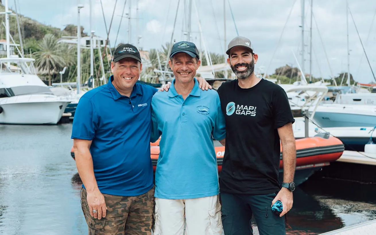
Proteus Ocean GroupThe Curaçao mapping team included Proteus Ocean Group, R2Sonic and Map the Gaps.
The Curaçao mapping effort takes place as teams around the world are working to create detailed maps of the ocean floor. While the entire ocean has been satellite-mapped at low resolution, according to the National Oceanic and Atmospheric Administration, the smallest chunk of the sea it can display is about a mile at a time, offering a “general picture of what’s down there” with “limited detail.”
“Imagine you live in a three-story home but only know the first floor,” says Map the Gaps co-founder Tomer Ketter. “There could be many things you've never seen on other floors. That's where we're at in terms of understanding our ocean and the seafloor.”
In comparison, scientists and ocean explorers who map with modern multibeam sonar systems can achieve a resolution of 328 feet. Currently, only about five percent of the global ocean has been mapped with sonar technology. The Curaçao sonar map will add to this body of data.
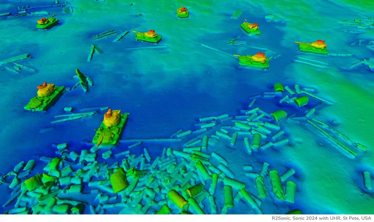
Map the GapsAn example of a site map created with sonar, showing tanks underwater in St. Petersburg, FL
“All the resources we survive on are all driven by factors that are governed by the seafloor,” says Ketter, and the depth and physical shape of the seafloor are the “very basic layer of understanding” necessary for all the physical sciences, including climate, fisheries management and oceanography.
The Curaçao map will provide resolution detail as small as three feet in some locations, revealing seafloor substrates including coral reefs, sand dunes, ripples, scour marks from strong currents, and more. Such maps could uncover features “previously unseen” or entirely new to science, NOAA notes. Cousteau says they might even reveal damaged areas that need to be addressed.
After the data is processed into a high-resolution map, he will return for final siting decisions. He hopes for an installation date for Proteus in late 2024 and mission 1 at the end of that year.
“The mapping couldn’t have been any more successful,” Cousteau says. “I’m really excited to move forward, and, on the horizon, we’re already looking at Proteus 2 and 3.”


